

A variation of just a few centimetres in the ice becomes an actionable signal when it feeds into a time series, an ice-dynamics model and, ultimately, a sea-level projection that can inform decisions at coastal scale.
In February 2026, the Monaco Polar Symposium, organised as part of The Polar Initiative, brought together 170 participants from 31 countries and territories to prepare for the fifth International Polar Year, IPY5, scheduled for 2032 and 2033. Its report identifies 17 potential initiatives across five pillars, with a clear direction: to build long-term infrastructure connecting observation, data, modelling and decision-making.
Radar satellites, laser altimetry, underwater robots, drifting stations, artificial intelligence and digital twins are beginning to form this architecture.
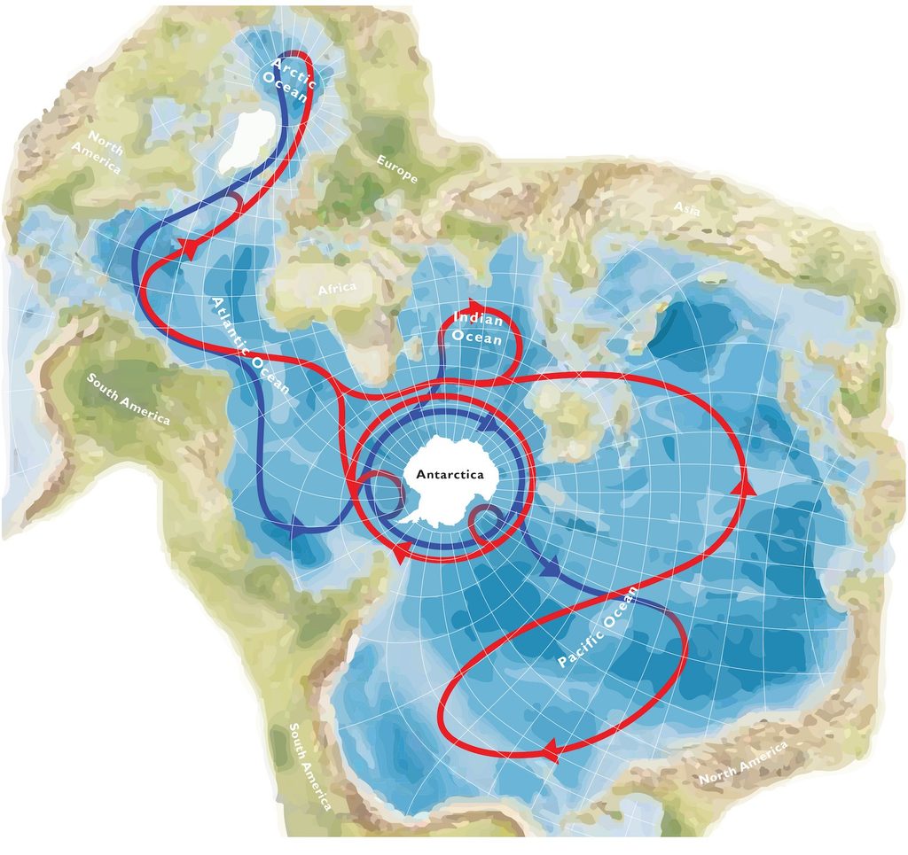
The Earth shown in a Spilhaus projection. Unlike conventional map projections, it places the ocean at the centre, enclosed by land. Global thermohaline circulation is illustrated with upper-layer flow in red and deep-layer flow in blue. © Michael Meredith, 2019 – The Polar Initiative
Observing the poles continuously
From radar to laser: tracking ice from orbit
At high latitudes, darkness, cloud cover and sheer geographical scale limit optical observation.
Finnish company ICEYE operates a constellation of satellites equipped with synthetic aperture radar, SAR, capable of acquiring imagery regardless of daylight and through cloud and fog. For sea ice, the operator offers daily acquisitions, with several observations per day possible over some areas, to track the location, movement and evolution of ice-covered surfaces.
Repeated satellite passes provide temporal resolution; altimetry, height.
NASA ICESat-2 satellite uses ATLAS, a photon-counting laser altimeter firing 10,000 pulses per second. Measurements are spaced roughly 70 centimetres apart along the satellite’s ground track. For sea-ice freeboard, the mission targets an uncertainty of no more than three centimetres over 25-kilometre segments where sea-level references are available and skies are clear.
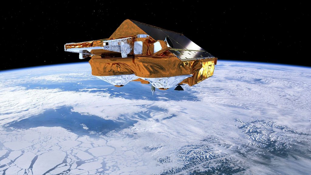
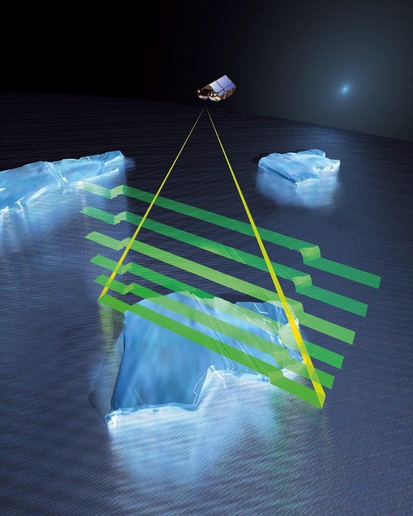
Europe adds another layer with CryoSat. Launched in 2010, the ESA satellite carries SIRAL, an interferometric radar altimeter designed to measure sea-ice thickness and track changes in the Greenland and Antarctic ice sheets. Its orbit extends to 88° north and south.
CryoSat provides the first continuous year-round altimetry measurements of Arctic sea-ice thickness. Applying artificial intelligence to the data helps correct the interference caused in summer by melt ponds forming on the ice surface. © European Space Agency
Under the ice, robots extend the measurements
Temperature, salinity, ocean circulation and heat fluxes at the interface with ice shelves require in-situ measurements, often in areas that remain difficult to access for months at a time.
In March 2026, the British Antarctic Survey published a system designed for autonomous Slocum underwater gliders operating beneath the ice. A secondary control system combined with an upward-looking altimeter allows the vehicle to adjust its route, detect ice overhead, identify potential surfacing areas and trigger safety procedures. The system was deployed in the Weddell Sea as part of the BIOPOLE programme, with under-ice mission sequences described in a British Antarctic Survey publication.
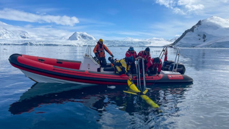
Deployment of an autonomous Slocum underwater glider near Sheldon Glacier, Antarctica. © Athena Dinar – British Antarctic Survey
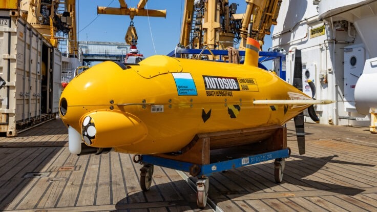
Autosub Long Range, nicknamed “Boaty McBoatface”, aboard the RRS Sir David Attenborough. This long-range autonomous underwater vehicle is used by the National Oceanography Centre for polar research into interactions between the ocean and glaciers. © Tom Acton / British Antarctic Survey
NASA’s Jet Propulsion Laboratory is developing a more specialised architecture with IceNode. The concept involves a fleet of autonomous robots capable of drifting beneath Antarctic ice shelves before attaching themselves to their underside to record temperature, salinity and circulation directly within the melting zone.
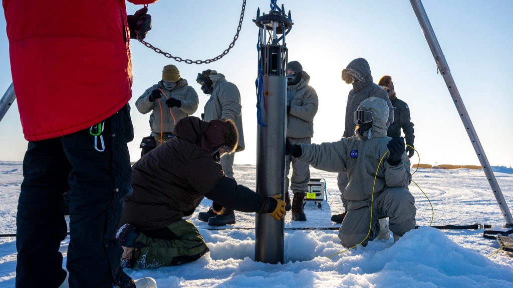
IceNode prototype during an under-ice test north of Alaska in March 2024. The system is being developed to measure melting directly at the interface between the ocean and Antarctic ice shelves. © U.S. Navy – Scott Barnes – Jet Propulsion Laboratory
A prototype completed its first test in a polar environment in the Beaufort Sea in March 2024. Lowered to a depth of around 100 metres, it collected temperature, salinity and current data during a test documented by JPL. The programme remains under development ahead of a possible deployment beneath Antarctic ice shelves.
With Tara Polar Station, the Tara Ocean Foundation launched a twenty-year programme in the central Arctic Ocean in 2026. Ten expeditions are planned through to 2046, with missions lasting up to eighteen months and around 90% of the time spent locked in the ice. The platform combines atmospheric observation, sea-ice monitoring, oceanography, biology and physicochemical measurements within a single drifting system.
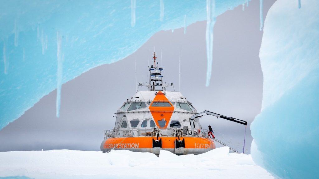
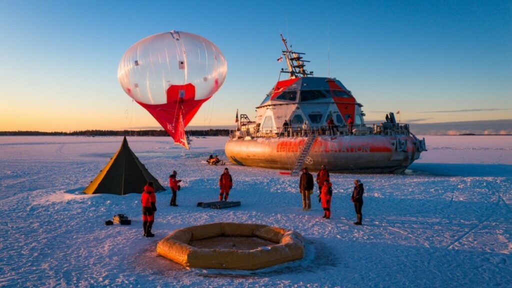
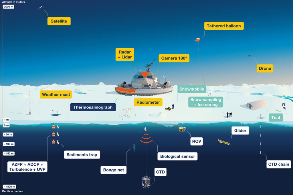
Tara Polaris Scientific Base. © Tara Ocean Foundation
Turning measurements into a polar model
Data volumes increase with the number of platforms, acquisition frequency and diversity of sensors.
The Monaco Polar Symposium report identifies a more structural issue: scientific data, citizen-science observations, national programmes and Indigenous knowledge remain distributed across systems with different formats and access rules.
The Polar Knowledge for All initiative proposes a global AI-ready inventory built on open standards and governance rules that recognise the rights associated with Indigenous knowledge.
Polar Twin: AI trained across both poles
The AI for IPY5: The Polar Twin project, presented in the same Monaco Polar Symposium 2026 report, takes this architecture into artificial intelligence.
The report describes a suite of foundation models trained specifically on circumpolar data. Satellite imagery, ocean observations, Indigenous ecological knowledge and citizen-science contributions could feed an infrastructure spanning both the Arctic and Antarctic.
The proposed system is intended to ingest continuous observation streams, detect signals at continental scale, integrate several thousand variables and identify critical thresholds within noisy datasets. Polar Twin remains a proposed IPY5 initiative, with planned stages covering governance, data protocols, computing partnerships and the development of the first models specifically trained on polar regions.
From the outset, the framework includes consent, attribution, conditions of use and community sovereignty over digital archives.
Destination Earth: the European precedent
An operational point of comparison already exists in Destination Earth.
Its Climate Change Adaptation Digital Twin produces global climate simulations at kilometre-scale resolution. Outputs released in September 2026 cover the period from 1990 to 2049, with spatial resolutions of 5 to 10 kilometres and hourly outputs. Integrated applications convert these simulations directly into indicators for hydrology, energy, wildfires and extreme precipitation.
Three Earth system models, IFS-NEMO, IFS-FESOM and ICON, run on EuroHPC infrastructure. Their shift towards repeatable, continuously evaluated production cycles moves climate simulation towards sustained operational use.
On 23 September 2026, Destination Earth presented an AI component dedicated to sea ice. Trained on several decades of reanalysis data, it learns the evolution of sea-ice cover and surface-ocean conditions directly from those datasets. Early results presented by the programme indicate that it runs faster than conventional physics-based models for this specific component.
Destination Earth’s Sea Ice AI component, developed to reproduce the evolution of sea ice and surface-ocean conditions from reanalysis data. © ECMWF – Destination Earth
The Polar Twin proposed in Monaco would add circumpolar specialisation, coverage of both polar regions and governance tailored to scientific and Indigenous data.
From ice to coast: turning forecasts into warnings
A change in Antarctic ice-sheet mass does not translate into the same coastal impact everywhere.
Local projections must account for ice-sheet dynamics, thermal expansion of the ocean, circulation, bathymetry, tides, vertical land movement and coastal morphology.
Poles to Coasts: moving from global sea level to exposed coastlines
The Poles to Coasts initiative proposed by the Monaco Polar Symposium aims to produce high-resolution sea-level projections that can inform local decision-making.
The programme would combine ice-sheet modelling, ocean physics, coastal geomorphology and social sciences. It also plans to consolidate currently fragmented datasets covering coastal bathymetry, tidal ranges and erosion.
The intended applications are operational: coastal protection, infrastructure investment and managed retreat. The project focuses on exposed territories and refers to more than one billion people living along coastlines affected by sea-level rise.
A port, coastal road or flood defence needs a level of resolution that global projections alone cannot provide.
Polar Early Warning System: detecting critical thresholds
The 2026 report also proposes a Polar Early Warning System for Global Action.
Its remit is to detect signals indicating that critical thresholds associated with ice sheets and sea level are being approached, with enough lead time to prepare a response. No integrated system of this kind currently exists at planetary scale for the polar regions.
The proposed architecture combines autonomous underwater vehicles, airborne ice-penetrating radar, robots operating on the ice surface and existing observation networks such as Argo, GCOS, SOOS and SOOP. Outputs would feed into agricultural planning, humanitarian logistics, planning for population displacement, infrastructure reinforcement, and environmental and financial risk models.
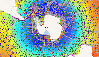
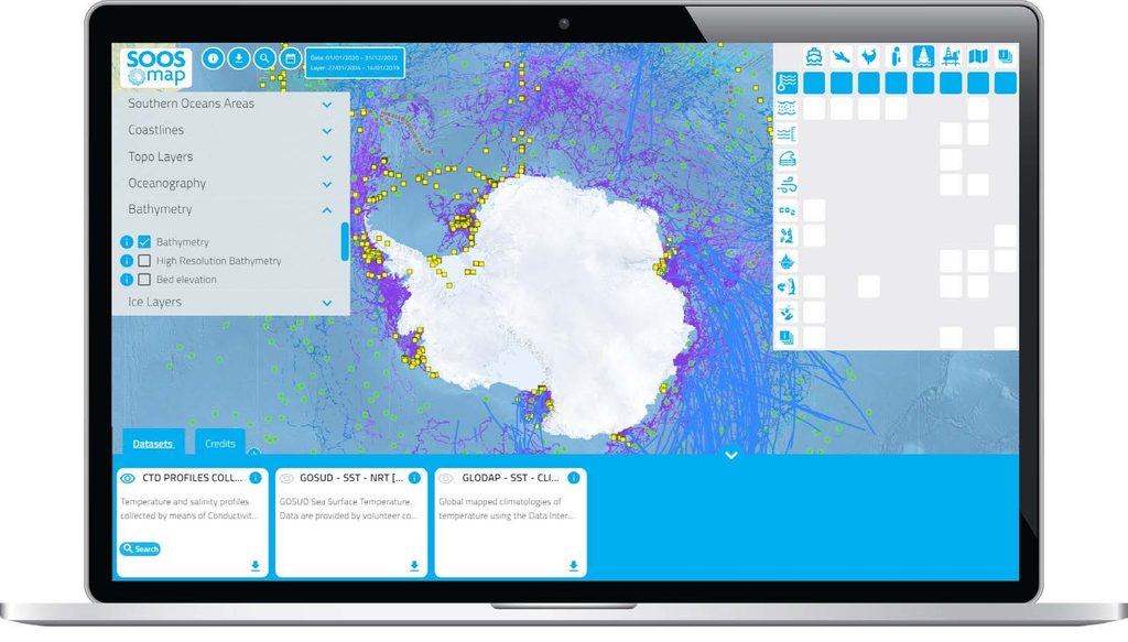
Interface of SOOSmap, the interactive portal of the Southern Ocean Observing System. The platform brings together more than 50 data layers and over 50,000 observations from international oceanographic and Antarctic programmes. © SOOS – EMODnet Physics
This continuity requires infrastructure that can outlast conventional research funding cycles. Three-to-five-year grants are poorly suited to decadal observations, continuous modelling, data maintenance and the retention of technical expertise. The mechanisms proposed for IPY5 range from staged funding from pilot to programme level to dedicated instruments, blended finance and new sources of funding.
International coordination is beginning to take shape. In August 2026, IPY5 selected Norway to host its International Coordination Office, in partnership with the Republic of Korea and Chile. The office is expected to become operational in 2027 and support preparations for the 2032–2033 International Polar Year.
The next generation of polar infrastructure will depend on continuity between measurements beneath the ice, computation and coastal decision-making.