

In 2026, the forest fires season is set to be particularly severe. With the expected development of the El Niño phenomenon, there are fears that the tragic record set in 2022 – when 62,000 hectares went up in smoke in France, the equivalent of 60 per cent of the area of Paris – could be surpassed. It is against this backdrop that the EDHEC Climate Institute and Climate Innov are simultaneously launching ensemblepourlaforet.fr and SecuFire Action, creating a seamless link between public information, regional planning and support for operational public decision-making.
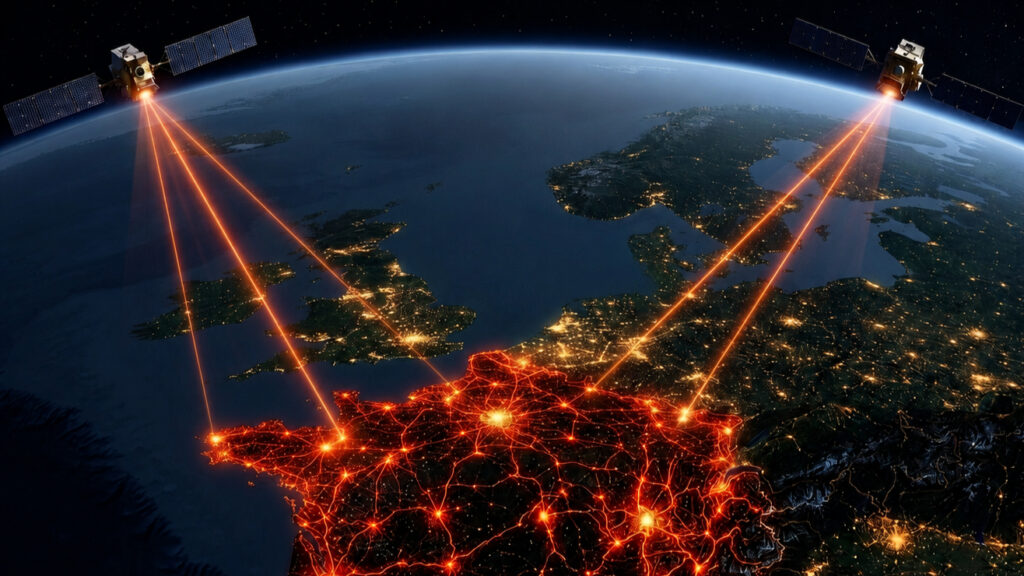
The principle is clear: a single foundation of satellite data, artificial intelligence and scientific modelling underpins both platforms. The first is aimed at all citizens, providing a free forecast of the risk of a fire starting. The second is aimed at public sector stakeholders, offering a professional tool for analysis and decision-making support.
The benefits of this partnership: the EDHEC Climate Institute provides a framework for applied research into climate risks and decision support. Climate Innov contributes the scientific engineering expertise: space technology, artificial intelligence, physical modelling of fire spread, automated data acquisition, advanced analysis and software development.
The value of this partnership lies in the combination of two complementary fields: climate research, which shapes our understanding of risk, and operational engineering, which transforms that understanding into a practical tool. It enables us to move from available data to actionable data.
A risk forecast for everyone
The first component, ensemblepourlaforet.fr, provides the general public with a forest fires risk forecast. The service is free and requires no registration. It is based on a uniform resolution of 3 km across the whole of mainland France, with hourly forecasts up to 36 hours in advance.
This approach responds to a key development: wildfire risk is no longer confined to the Mediterranean departments. Models based on ground-based monitoring stations can lose accuracy in the most exposed or least forested areas: isolated woodlands, Corsican maquis, and Alpine valleys. The satellite-based approach developed by the EDHEC Climate Institute and Climate Innov aims to provide a consistent assessment of risk across the whole of mainland France — with no gaps in coverage and no blind spots.
The public engagement aspect is based on a key fact: in France, one in two forest fires is caused by an unintentional human action, and nine out of ten fires are man-made. A cigarette butt, a barbecue, or a domestic or agricultural spark can be enough when the right conditions are present.
In this context, information becomes a tool for prevention. Before going on a hike, spending a weekend in the forest, travelling near a mountain range or carrying out an everyday activity, knowing the level of risk enables people to adapt their behaviour accordingly.
The aim is not to shift the responsibility for fire prevention onto the public. It is to highlight the moment when an ordinary action can become a risk factor.

Before heading out, simply checking the map allows people to adjust their behaviour and avoid contributing to the risk of fires breaking out. © ensemblepourlaforet
A decision-making tool for public sector organisations
The second component, SecuFire Action, is aimed at public bodies involved in forest fires prevention and suppression: fire and rescue services (SDIS), local authorities, public forest managers and public operators of critical infrastructure. The tool is made available free of charge on a long-term basis, upon request to Climate Innov, as part of a partnership agreement with the EDHEC Climate Institute and Climate Innov.
SecuFire Action complements the meteorological foundation with specialised modules: topography, vegetation, land use, fire progression forecasting, DFCI zoning, and natural and artificial water sources — to which a tactical memory module for past fires, currently under development, will be added. These modules can be rolled out gradually or deployed together depending on operational needs.
A fire spreads according to several factors: the weather, slope, fuel, vegetation corridors, exposed infrastructure and the accessibility of water sources. Fire history, meanwhile, enables lessons to be learnt from past events and helps to better inform future decisions.
SecuFire Action combines these layers to provide a more comprehensive picture of the situation. The prediction module is based, in particular, on a physical model of fire propagation derived from the Balbi model. This model was developed as part of the ‘Feux Project’ at the SPE Laboratory, CNRS – Università di Corsica Pasquale Paoli, and subsequently implemented and commercialised by Climate Innov for operational use; its evaluation was carried out in collaboration with the IMATH laboratory at the University of Toulon, as part of the ‘Med’Innov’ university innovation programme.
The tool also draws on sources and databases such as Sentinel-2, EUMETSAT, Spire Global, GFS and ERA5. The partnership with Spire Global — owner of the world’s largest commercial constellation of small radio-occultation satellites — is presented as a key asset for anticipating micro-variations in wind, pressure fluctuations and local hygrometric changes that may influence the behaviour of ground fires.
In the field, the tool has three main applications. Firstly, real-time command support: as soon as an alert is raised, the prediction module projects the fire’s path to identify areas requiring evacuation, sites requiring protection and the optimal positioning of resources. Secondly, prevention and preparedness for crisis management: in advance, the incorporation of extreme weather scenarios enables vulnerabilities to be mapped and business continuity plans to be refined. Finally, securing sensitive sites: for Seveso and industrial managers, the tool informs internal operational plans and local fire risk plans (PPRTs), where fire risk modelling is mandatory.

An hour-by-hour forecast of the fire risk level, with a 36-hour forecast horizon. © ensemblepourlaforet
Data supporting expertise in the field
SecuFire Action is not intended to replace the expertise of teams on the ground. Decisions remain the responsibility of operational teams. The tool is designed to enhance this expertise by providing reliable, up-to-date and directly actionable information.
In a fire-fighting operation, data is only valuable if it can be interpreted by decision-makers. Useful information is not merely accurate; it must be clear, contextualised and ready for use at the very moment when rapid decisions are required.
This is where SecuFire Action comes in: helping to anticipate a fire’s likely path, identify areas to protect or evacuate, visualise critical infrastructure, locate water sources, prepare resources, and then capitalise on historical data and lessons learnt.
“In the face of changing fire risks, it is our responsibility to ensure that research and innovation can be harnessed for the benefit of those who protect our regions and communities. With this initiative, the EDHEC Climate Institute is making a concrete and long-term commitment.” Camille Angué, Director of the EDHEC Climate Institute
“Our aim is not to replace the expertise of the emergency services, but to provide them, in a crisis situation, with aggregated and filtered information – the most reliable and accurate available – on the likely progression of a fire. Every minute saved and every better-informed decision can make all the difference.” Ahmed El Fadhel, Co-Founder & CTO, Climate Innov
The benefits outlined should be understood in this context. The documents refer to a reduction in the area burnt of up to 30 per cent, a target to reduce CO₂ and fine particulate emissions by 10 to 30 per cent, as well as a reduction in infrastructure losses, biodiversity loss and the costs of firefighting and reforestation. These figures reflect an impact objective linked to improving the anticipation and targeting of resources, not an automatic guarantee applicable to every situation.
Two tools, one chain of responsibility
The initiative’s originality lies in its dual level of application.
Citizens have access to clear information to adapt their behaviour. Local authorities and public administrators prepare their areas. Emergency services coordinate and respond. Research and engineering ensure that the information is usable at each of these levels.
This shared responsibility does not blur the roles; it links them together. This is where the EDHEC Climate Institute–Climate Innov partnership comes into its own: it integrates technology into a chain of use that is free for all, structured for public sector stakeholders, open to feedback and grounded in a scientific understanding of risk.
The information provided remains subject to estimation risks, with uncertainties linked to the conditions under which the models are used and the quality of the data collected. Data therefore does not eliminate uncertainty; it enables us to better characterise it.
The aim is not to claim to predict everything. It is to make risk understandable earlier, at the right scale and for the right stakeholders.
A few hours’ lead time to adjust behaviour. A few minutes gained to inform an operational decision. A structured record to prepare for the coming seasons.
The EDHEC Climate Institute–Climate Innov partnership turns foresight into a shared infrastructure for protecting regions, from individual actions to operational decisions.
About

The EDHEC Business School’s research centre dedicated to the challenges of climate change and climate finance. Its mission is to support public and private decision-makers in understanding and managing climate risks, as well as in financing the transition to a low-carbon and resilient economy. It carries out internationally recognised research into the physical and transition risks associated with climate change.

A Franco-Tunisian research and engineering company dedicated to innovation in the fight against climate-related risks, organised around five integrated scientific divisions. It designs solutions combining space technology, artificial intelligence and scientific modelling to better anticipate and manage risks.